Walking the Myrtle Gully Track
|
I have been away a fair bit recently and haven’t had much of a chance to get out and enjoy the Tasmanian wilderness so I was missing it. Not having a whole lot of time one weekend, Dad and I decided we would just go for a walk on the mountain by taking Myrtle Gully track up to Junction Cabin.
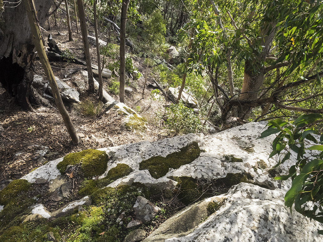
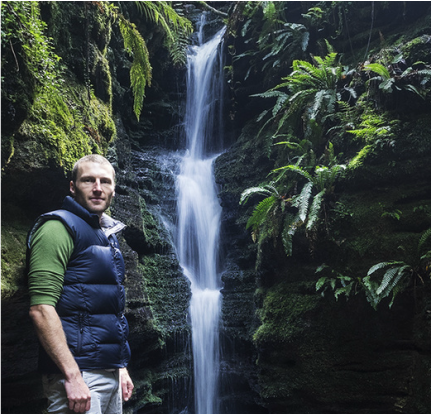
It was a pretty mild day. The downpours that led to the floods were just around the corner, but had not arrived yet so we were enjoying the continued balmy late-Autumn weather. We met in south Hobart and joined the Cascade Rivulet Track just behind the brewery, following it uphill to where it became the Myrtle Gully Track at the end of Old Farm Road. The Gully itself was steep-sided and incredibly green, dense with mossy trees and ferns. A light overhead canopy gave overall coverage that was as patchy as fibre-to-the-node NBN plan, but still made the gully darker than the outside world. We had been going for about thirty minutes when we took a little detour down a short incline that barely qualified as a marked path. It dropped down the side to the gully as sharply as milk prices offered to Tasmanian farmers and quickly took us to Secret Falls, which was particularly badly named, judging by the number of people already clustered in the little alcove below the falls. After a few minutes having a look at the falls, we climbed back to the track and continued. |
|
|
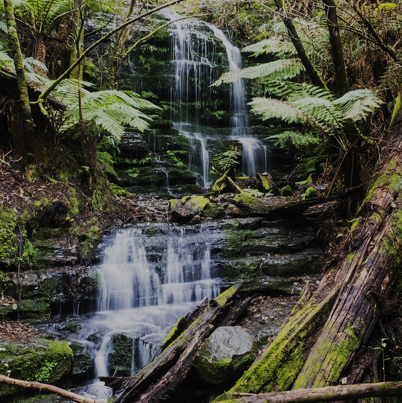
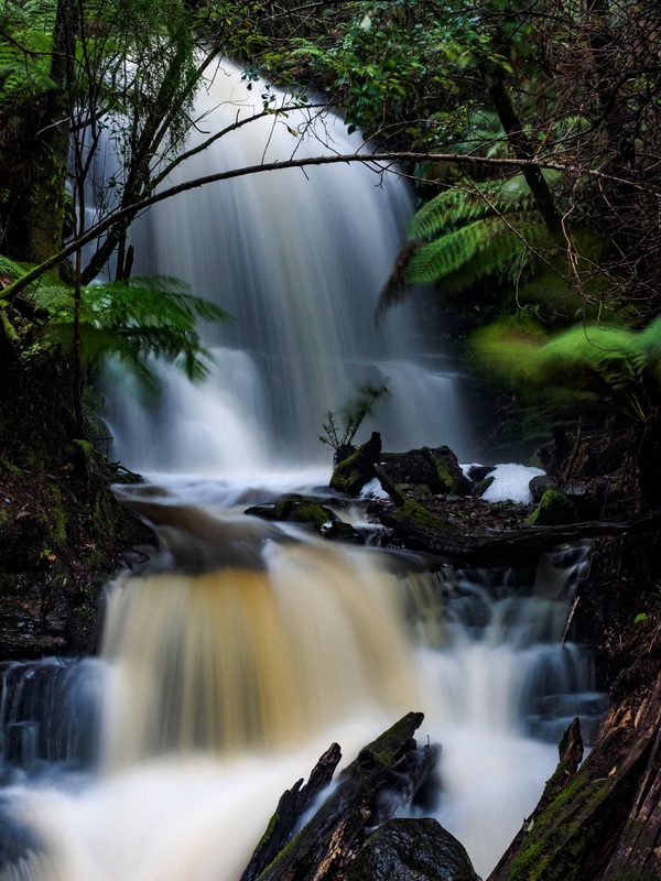
A little further up the gulley, the track crossed a bridge above the creekline with Myrtle Falls cascading down not far to our right. After a bit of rain the previous week, there was plenty of water on the falls, but a few weeks later after the downpour water was flowing faster than money to marginal electorates.
After another thirty or forty minutes of fairly gentle climbing, the track turned sharply to the right, hinting with Malcolm Turnbull-like sincerity that it was changing course away from the creek. And much like our PM, this is a false turn, as the track quickly turns back on itself again and continues its original course. A little further on, the track does indeed leave the gulley, coming out on a fire trail not far from Junction Cabin. Instead of stopping in the peaceful clearing of the cabin, we decided to continue a little further, pushing a few hundred metres up Hunter’s Track to a point where the ground flattens out. From here, we again departed the main track on a little-known path to the right that was less clear than the plot of Lost. After more mis-steps than the Australian Christian Lobby, we got to the top of a rocky escarpment with a natural cave below us. Someone had built a stone wall at the mouth of the cave to keep the wind out to create a perfect shelter and the remains of a fire was evidence of its continued use. |
|
We stopped here for some afternoon tea, enjoying the view of a distant Hobart through the trees and the peaceful quiet of the surrounding bushland. After about half an hour we set off for home. This time we followed a faint track and some track markers that led us downhill from the cave, with the pretty safe assumption that we would pretty quickly hit a main track. Following the track to the cave had been a little challenging at times and I had needed to channel my inner politician to climb up on some high ground to figure out where to go next, but the trip back to Junction Cabin was much easier, as we couldn’t really miss the Lenah Valley Track below us, and once we hit that we followed it back to the cabin.
We were soon back into Myrtle Gulley and heading down to South Hobart. The light dimmed slightly and the sound of the rushing water greeted us quickly. The descent was a gentle gradient and the track is obviously quite popular as we encountered a surprising number of other walkers on the way. We reached the bottom of the gulley after about an hour and followed the Cascade Rivulet Track back to our start point. Including time at the cave the walk only took about three hours but provided an almost timeless escape from the everyday bustle of city living. 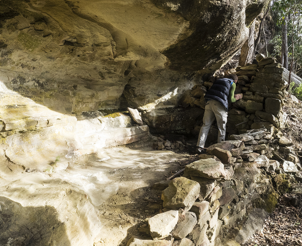
|
|